|
Copyright
© 2000-2003 Pavenham .Com - All Rights Reserved
|
CONTACT
WEBMASTER
cysco@pavenham.com
 
Close
Road is
a cul-de-sac of houses a mile to the east of Pavenham Village, where
Remains - thought to be of a Pre-Enclosure
Footpath, have been uncovered at the rear of No.17.
From
the time of the Enclosures of 1770 until the construction of the current
homes, the area was agricultural land with no recorded dwellings in
documents held by Bedfordshire County Archives.
The
Pre-Enclosure Map of 1769 however, and the Enclosure Awards
of 1770, suggest that a good deal of activity used to take place
at this end of the parish.
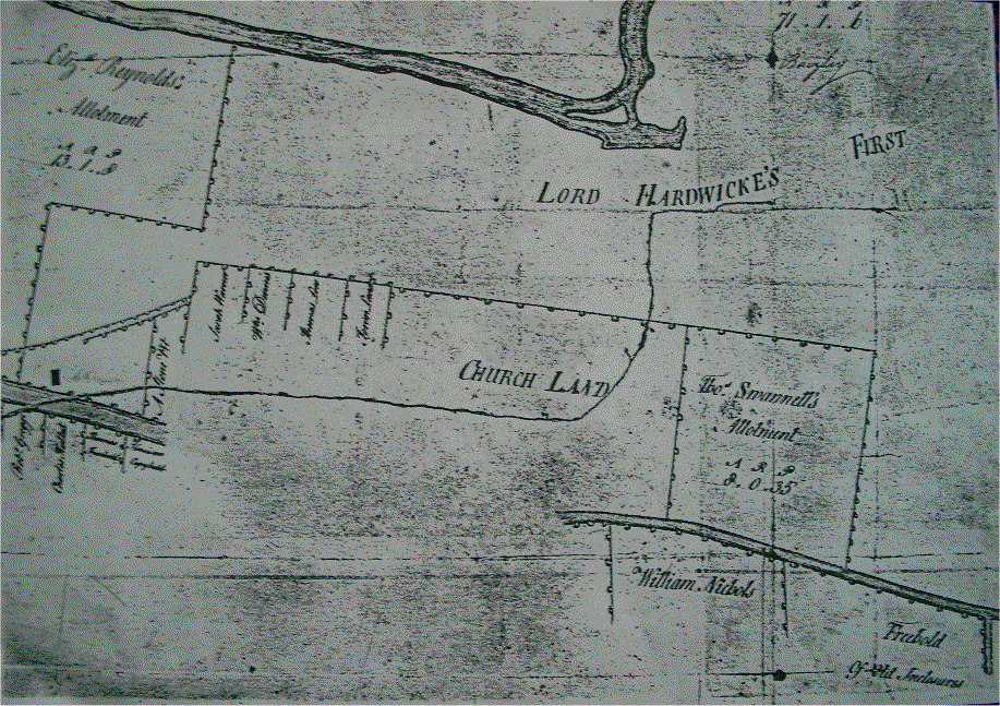
Map
of the Enclosures 1779..courtesy of Bedfordshire
& Luton Archive Services
Click to Enlarge....takes a while to download.
Number
One Stone Pit was a public area for the storing of stone for the repair
of the roads, and was the responsibility of the parish Overseer of
Highways.
The entry in the Enclosure Awards 1770 for Sarah Warner - apart from
stating her boundaries and obligations to maintain fences, ditches
and mounds - also mentions a cottage on the plot with Rights of Access
along a footpath running from The King's Highway, up behind the stone
pit and onto her plot.
It
seems that Close Road was built on these two parcels of land over
a century and a half later.
Preliminary
research has been undertaken, and even allowing for inaccuracies in
the 1769 Enclosure Award Map, an overlay of a current Ordnance Survey
Map aligned on different reference points, and a compass orientation
seems to verify the find.
At
this point in time a report of the findings is being prepared and
will be forwarded to the County Archeologist for verification and/or
further investigation, and this page will be updated when further
information becomes available.
Many
thanks to Bedfordshire & Luton Archives & Records Service
and Bedford Central Library whose assistance in this matter is greatly
appreciated.
© 3/7/2003
Pavenham.Com
 |